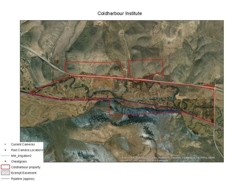
 We are engaged with many forms of research and ecological monitoring at the Coldharbour Institute including camera trapping, water quality testing, transects, wetland delineation, and plant surveys. With Western Colorado classes, past and current Clark Fellows, and other local learners involved with Coldharbour you can imagine we have no shortage of data. As a learning hub engaged in a regenerative network, we have a stewardship responsibility to the data (as we do to our land). Shared file organization with a logical, clear structure and labeling system not only makes it easier for our team to find data, but also enables our partners to access relevant data. Coldharbour Geospatial Data Management With Coldharbour’s many partners and research projects, data management is an iterative process but most recently we’ve tackled our geospatial data in ArcGIS. GIS data can be stored in many different formats. We opted to use a file geodatabase for storing and managing geospatial data as we have complex data storage needs. A File Geodatabase is essentially a folder for ArcGIS that offer structural, performance, and data management advantages. Setting Up a Coldharbour Geodatabase We are fortunate to have access to Western Colorado University’s shared GIS server which allows multiple students to collaborate on our File Geodatabase and for us to have a comprehensive inventory past students’ data.
Thinking about how you will organize your files and data early on can save you from having to reorganize and rename files later or having to track down important information. We’re still implementing data management beyond our geospatial database so stay tuned for future news updates and best practices that we learn along the way! Coldharbour Institute is a learning laboratory for regenerative living practices. Learn how you can support our research and mission today! Written by Chloe Beaupré, Clark FellowChloe is interested in wildlife - particularly, big game ungulates - and geospatial analysis. You can find her making maps of the Coldharbour property or behind a pair of binoculars.
3 Comments
|
Ongoing ResearchNotes from the field of Coldharbour Ranch. Archives
October 2021
Categories
All
|
 RSS Feed
Sign up for our newsletter below.
|
|
Coldharbour Institute is a 501(c)3 Non-Profit Organization
P.O. Box 463 Gunnison CO 81230 |